spacer
No current alerts for: "Lancashire (UK273); Merseyside (UK279); Greater Manchester (UK259); Derbyshire (UK237); Cumbria (UK233); Isle of Anglesey (UK268); County Antrim (UK227); County Tyrone (UK232)".
METRIC | IMPERIAL
Updated: 03/05/2024 @ 01:30   (0 sec ago)
Temperature Current Conditions Forecast / Storm Prediction
Currently Outside: Colder 0.4°C than last hour.

10.3°C

Feels like:  8°C
---
High Today
11.1°C
00:00
Low Today
10.3°C
01:20
Yest High
17.1°C
14:27
Yest Low
9.8°C
06:23
Sta* High
18.6°C
2008
Sta* Low
1.6°C
2010
* This Station's Records Since 6/2003
Official Record High
Night time, Clear Night time, Clear

Wind from E Wind:  E
11.3

Gusting to:
7.1 mph
Current Rain Rain:
0.0 mm
Tonight

Fog late
Fog late
Friday

Chance rain
Chance rain
Friday
night
Chance rain
Chance rain
Low: 11°C High: 13°C Low: 10°C

Click here for full Forecast
SPC Activity Map
Dew Point Liquid Precipitation Wind Speed Sun/Moon
Current: Decreased 0.3°C since last hour. 8.9°C
Last Hour: Decreased 0.3°C since last hour. -0.3°C
High 00:00: 9.5°C
Low 01:05: 8.8°C
Record High: 21.8°C on
8-Sep-2023
Record Low: -15.0°C on
1-Feb-2009
Wetbulb: 9.6°C
Rain Today
rain graph

Today: 0.00 mm
Yesterday: 0.00 mm
Last 7 Days: 31.60 mm
May Rain: 1.00 mm
May to Date
  Avg:10
0.00 mm
May to Date
  Diff from Avg:10
Over 1 mm for the month 1.00 mm
May Avg: 54.50 mm
Diff from Avg: Under 53.5 mm for the month 53.50 mm
Season:1 434.4 mm
YTD
  Avg:11
294.50 mm
YTD
  Diff from Avg:11
Over 139.9 mm for the year 139.90 mm
Last Rain
Time/Date:
1-May-2024
at 05:38
84 rain days in 2024
1 day in May
1 day since last rain
Current: E  11.3 mph
1Hr Average: 18.9 mph
Wind Run: 26.01 miles
Wind Gust
Current: 7.1 mph
Today: 27.6 mph 00:34
Month: 29.5 mph 2-May
Year: 74.8 mph 21-Jan
Record Gust: 80.5 mph
10-Dec-2019
Sunlight:
15 h 20 m 19 s
of Sunlight Yesterday
15 h 24 m 14 s
of Sunlight Today
Which is
3 min 55 sec longer than
yesterday
15 h 28 m 7 s
of Sunlight Tomorrow
(Noon ?>) graph (Midnight
Legend

Waning Crescent
Waning Crescent, 24 days, 6 hours, 9 minutes in cycle
32%
Illuminated
Humidity Barometer
Current: Increased 1% since last hour. 91%
Last Hour: Increased 1% since last hour. 1%
High 01:07: 91%
Low 00:00: 90%
Record High: 100%
20-Feb-2011
Record Low: 17%
19-May-2008
Current: Rising 0.1  hPa/hr 1006.8 hPa
Last Hour: Steady
High 01:23: 1006.8
Low 00:43: 1006.5
Record High: 1048.2 hPa
29-Mar-2020
Record Low: 857.0 hPa
6-Dec-2007
Heating Degree Days Tide Wind Chill
Today: 0.3
May: 12.4
2024 to Date: 1295.2
Cooling Degree Days
2024 to Date: 0.0

12 hours, 45 minutes to low tide at
02:15 PM BST


Current: 7.9°C
Low 01:20: 10.3°C
Yesterday: 6.5°C
Record: -11.5°C
1-Mar-2018
UV Summary/Forecast Solar Summary
High Yest:   4.1 @ 13:40
May-03

4.0
May-04

4.0
May-05

3.9
High Yest:   807.0 @ 13:47
Sun Hours Today:
00:00
   This Month: 13:19 Hrs
Rise: 05:35  Set: 20:55
Almanac Irrigation Index5 Station All Time Records Cloud Level
Currently: Night
YTD Avg Temp: 7.8°C
Sunrise: 05:35
Sunset: 20:55
Moonrise: 04:26
Moonset: 14:22
Full Moon: 24-Apr-2024
New Moon: 03:23 UTC
08-May-2024
Updated at Midnight
Current ET: 0.90 mm
7-Days Rain: 31.60 mm
7-Days ET: 15.70 mm
7-Day:  15.9 mm water in excess of what evaporated in last 7 days. 15.9 mm
May:  5.7 mm water in deficit of what evaporated this month. 5.7 mm
HIGHS: LOWS:
30.6°C
18-Jul-2022
-5.5°C
21-Dec-2010
Daytime Records
  29.2°C°C
25-Jun-2020
  -2.7°C°C
20-Dec-2010
Nitetime Records
  24.1°C°C
20-Jul-2016
  -4.1°C°C
21-Dec-2010
ICN:1 | S3C2:2 | Ajax 3.xx
ISS:Ok | CON:4.6 | RCP:96%
1 Rain season: Jan 1st to Dec 31st.   5 Estimated amount of water needed to replace the water used by plants and evaporation from the past week. (Negative numbers mean amount of water needed, positive numbers mean excess water is present).   10 Historical average only to day 3 of just the month of May for this station since 2004.   11 Historical average rain this season to day 3 of May for this station since 2004.
 WXSIM Weather Forecast  -   Outlook Tonight & Friday
Tonight

Fog late
Fog late
Low: 11°C
WXSIM forecast: Partly to mostly cloudy in the evening, becoming partly cloudy after midnight. Patchy light fog after midnight. Breezy. Low 11°. Wind east-northeast around 16 mph, gusting to 29 mph, in the evening, becoming 12 mph, gusting to 18 mph, after midnight.
Local station forecast: Mostly cloudy and cooler, precipitation possible within 12 hours, possibly heavy at times, windy.
Friday

Chance rain
Chance rain
High: 13°C
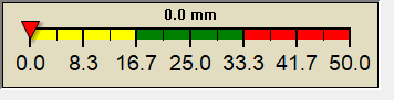
WXSIM forecast: Cloudy in the morning, becoming dense overcast in the afternoon. Patchy light fog in the morning. A chance of rain. High 13°. UV index up to 1. Wind northeast around 6 mph in the morning, becoming north around 3 mph in the afternoon. Chance of precipitation 40 percent. Precipitation mostly less than 2 mm.
 WXSIM Short Term Weather Forecast
Friday
night
Chance rain
Chance rain
Saturday

Overcast
Overcast
Saturday
night
Chance rain
Chance rain
Sunday

Chance rain
Chance rain
Sunday
night
Cloudy
Cloudy
Monday

Partly Cloudy
Partly Cloudy
Monday
night
Fog late
Fog late
Low: 10°C High: 13°C Low: 10°C High: 12°C Low: 9°C High: 15°C Low: 8°C
ajax-dashboard6.php - Version 6.95g - 18-Feb-2023 - Script by: Scott of BurnsvilleWeatherLIVE.com
Now supported by Saratoga-weather.org Download
Free Website Hit Counter
Free website hit counter